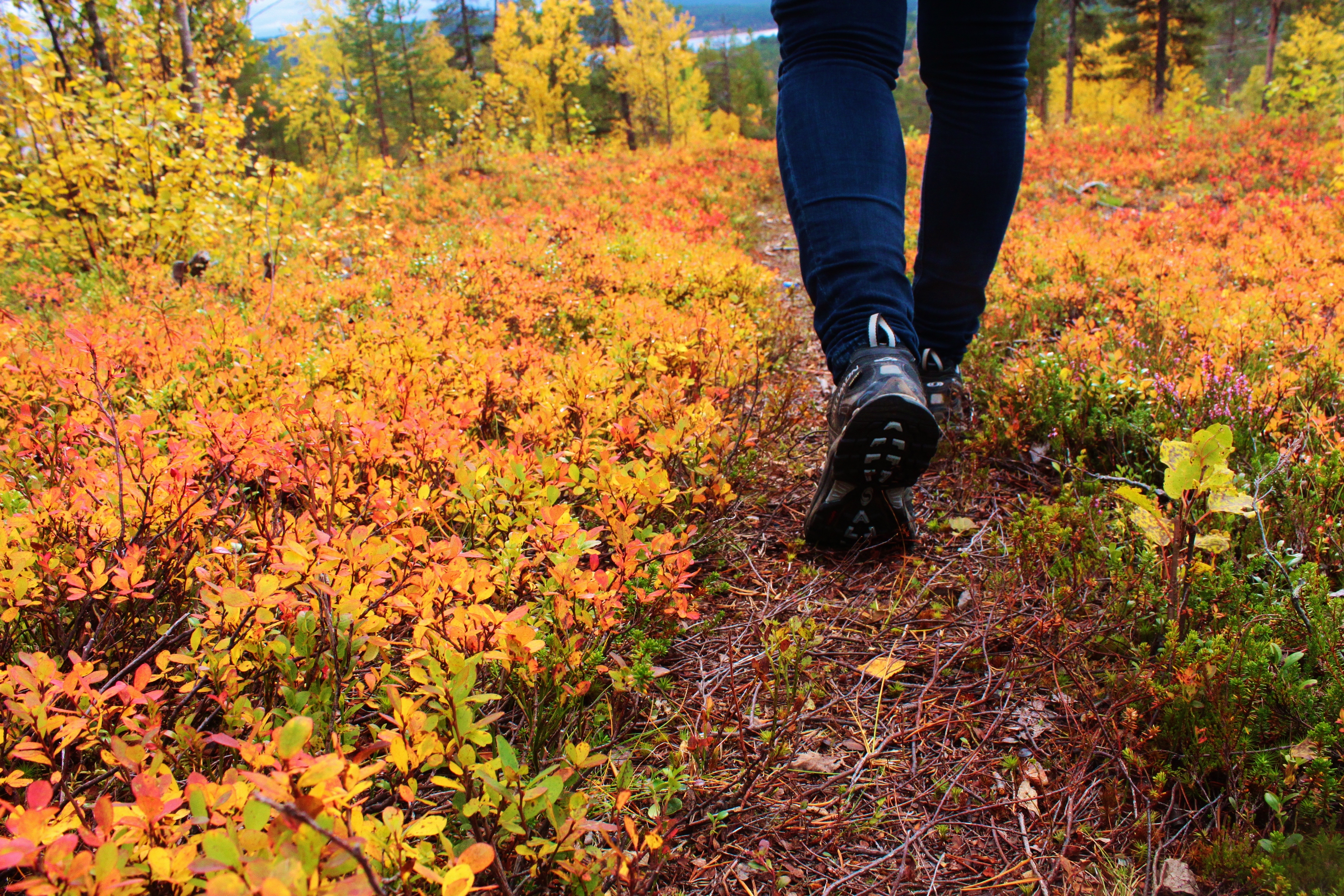
Unlike the wilderness areas around Hetta, whose trails are only for navigational experts, the National Park is dotted with well-marked trails leading through its most beautiful areas, with bookable and open huts to rest or sleep in every c. 10km. Note, though, that the fell weather can still change rapidly and help is far away in the event of an accident.
Pallas-Yllästunturi is Finland's third largest National Park. Its highest fell is Taivaskero, at 807m, and its forests mix northern and southern species, making for a very varied and interesting habitat.
- Finland's third largest National Park; highest fell Taivaskero (807m)
- Well-marked trails with open & bookable huts every c. 10km
- Classic 55km Hetta–Pallas Trail (outlined 1934)
- Car transfers between trail ends: €65 per transfer
- Best hiking late June – mid October
- Short nature trails around Pallas: Taivaskero 9km, Palkaskero 7km, Vatikuru 3km
The Classic 55km Hetta–Pallas Trail
One of the most popular hiking routes in Pallas-Yllästunturi National Park is the 55-km-long Hetta-Pallas Hiking Trail which was outlined already in 1934. (You can even run this route in a few hours if you take part in the 55km/1800m of ascent Hetta Pallas Ultratrail Run at the end of July.)
We are happy to arrange car transfers from one end to the other (€65 per transfer) or even to guide you on the journey itself. The best time for hiking is late June – mid October and the trail can be travelled in either direction, starting and ending either in Hetta Village or Pallastunturi Visitor Centre. At the Hetta end, hikers must start / finish by crossing Lake Ounasjärvi by boat. When travelling south from Hetta, the first open huts are at Pyhäkero; the next major stopping points are Sioskuru, Hannukuru and Nammalakuru, all of which have both open and bookable huts.
Short Trails around Pallas
In the area around the Pallas Visitor Centre there are a number of nature trails. The 9km circular Taivaskero route goes to the top of Taivaskero (4km from and c.340m higher than the Visitor Centre) and takes about three hours. The 7km circular Palkaskeron trail climbs to a high rocky point with views of all of Pallas's lakes and fells, as well as seven bronze squirrels — environmental art embodying the world's great religions. The 3km Vatikuru Nature Trail winds around the slopes of Pallastunturi, presenting the life and culture of the region.
Trails near Ketomella & Vuontispirtti
Vuontispirtti – Montelli Cabin – Vuontispirtti (10km roundtrip) is a beautiful, fairly steep 5km trail that leads into the National Park to a small, very old cabin, the Montelli open wilderness hut, nestled in the middle of the fells — one of the most beautiful spots in the park, also accessible in winter by ski track.
The Ketomella–Tappuri Trail (16km) leads up from the old ferry-stop at Ketomella on old boardwalks to the Sami reindeer marking village of Tappuri, up amongst the high fells amidst stunning landscape.
Towards the Southern End of the Park
A so-far little-used trail, recently remarked, leads from the Pallastunturi Fells via Lommoltunturi Fell south towards the Yllästunturi Fells. The Ylläs–Rauhala–Pallas Trail (72 km) takes you through beautiful woodland and across hills, starting either at Yllästunturi Visitor Centre Kellokas or Pallas Visitor Centre. Please note the Äkäskero–Rauhala route is a fair distance and route markings are sometimes incomplete; you will need to bring a tent, as there are huts only at Pahtavuoma and Kutujärvi.
Around Ylläs, the popular 4-km Varkaankuru Trail (Wizard's Trail) begins at Kellokas Visitor Centre and leads through Varkaankuru Ravine.